The North Carolina Cityscape at night

November 16th, 2013

Now for the North Carolina cityscape at night. In case you missed it, here’s the daytime panoramic. Like the daytime version, this is composed from my personal photograph stock around the state. So if something is missing, I likely never took of picture of it myself. Head over to MetroScenes.com to find some of the source photographs.

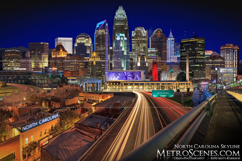
North Carolina Skyline at night by Matt Robinson
Buy a print or Download file (license) Link to this photograph.
A zoomable version:

Comments

  1. Anonymous says:

    November 16th, 2013 at 11:43 pm (#)

    You got it Matt. I see 7 cities in the mix. Looks good.

  2. Anonymous says:

    November 17th, 2013 at 6:50 pm (#)

    Sweet

  3. Anonymous says:

    October 8th, 2014 at 9:59 pm (#)

    Wow, this is unimaginably clear and perfect picture. You are so good. Every light is crisp. Which camera and lens did you take the picture with? Ia m sure with your skills you can do it with any camera in your hand!! Great hands.

  4. Anonymous says:

    October 9th, 2014 at 11:50 am (#)

    Greg Hatem is developing plans to build a tower up to 30 stories high on the 1-acre vacant lot he owns at 600 W. Hargett St

    Read more here: http://www.newsobserver.com/2014/10/08/4218123_citrix-systems-injects-new-blood.html?

  5. Anonymous says:

    October 11th, 2014 at 6:39 pm (#)

    My observations & predictions from what I have read from you guys and different articles.
    South Saunders Street view is Beautiful, the city skyline will connect from Charter Square, Over to Ted Reynolds & Mr. Tatums’ new towers
    Union Station will be an interesting flow of Buses, Regional Rail, High Speed Rail other modes of transportation. FACT=Raleigh doesn’t have a river going through the downtown area.
    Many cities have rivers going through the downtown areas, creating a beautiful scenery. Cities like;
    Columbus, Ohio /Austin, Texas/ Richmond, Virginia/ Jacksonville, Florida. I know I left a few cities off of the list.
    Capital Boulevard runs into downtown in a comparable way as a river.
    Capital Boulevard is that imaginary river leading into the city from the North. Most of the properties are Commercial and/or industrial real estates. Building North along Capital Boulevard will begin after Glenwood South & the Warehouse District run out of space. The problem of any possible flooding will be terminated from dynamic control methods emplaced by the City /possible Coordination with the Army Corps of Engineers. Downtown skyline, Midtown/North Hills small skyline will grow, connecting to the three towers in Highwoods Office Park. Atlanta built along I-85…the imaginary river running through town.
    Smart land use, added density, and more life into our downtown area.
    Raleigh will look very different in the next 15 years

  6. Anonymous says:

    October 13th, 2014 at 3:02 pm (#)

    Keddrick , Would you give me some info. on the towers you mention concerning Ted Reynolds & Mr. Tatum building in the future ? Thanks , Dwight Nipper

  7. Anonymous says:

    October 15th, 2014 at 9:18 pm (#)

    No insight, it is just a prediction…..a wish 🙂

  8. Anonymous says:

    October 15th, 2014 at 10:33 pm (#)

    Keddrick , “My Wish Also” !

  9. Anonymous says:

    January 28th, 2021 at 12:40 pm (#)

    Fabulous image !
    May i ask the location it was taken from please ? I will be driving through Raleigh tomorrow morning and would love to take daytime pix from the same or similar perspective on my way through. Many thanks in advance. 🙂

Leave a Comment


The North Carolina Cityscape at night


Want to use RaleighSkyline.com photographs for commercial purposes? Please see the image licensing page.